Best Cities to Invest in Plots in India 2026: Data-Backed Top 10 List
Top 10 Indian cities for plot investment ranked — Hyderabad, Bengaluru, Pune, Chennai, Jaipur and more.
Loading Experience...
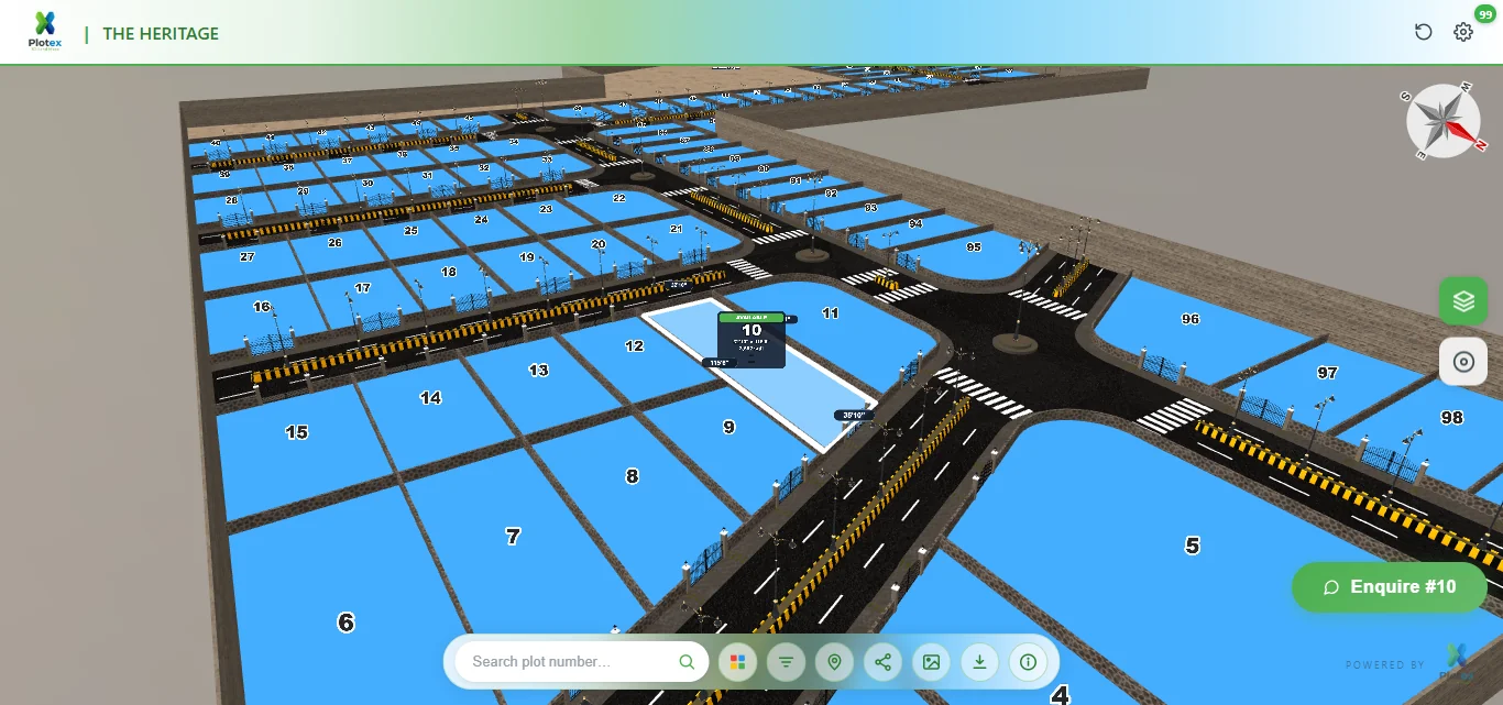
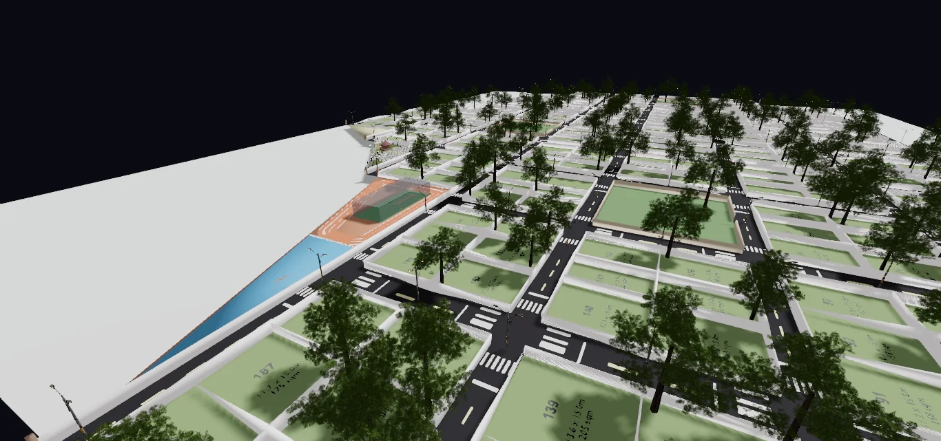
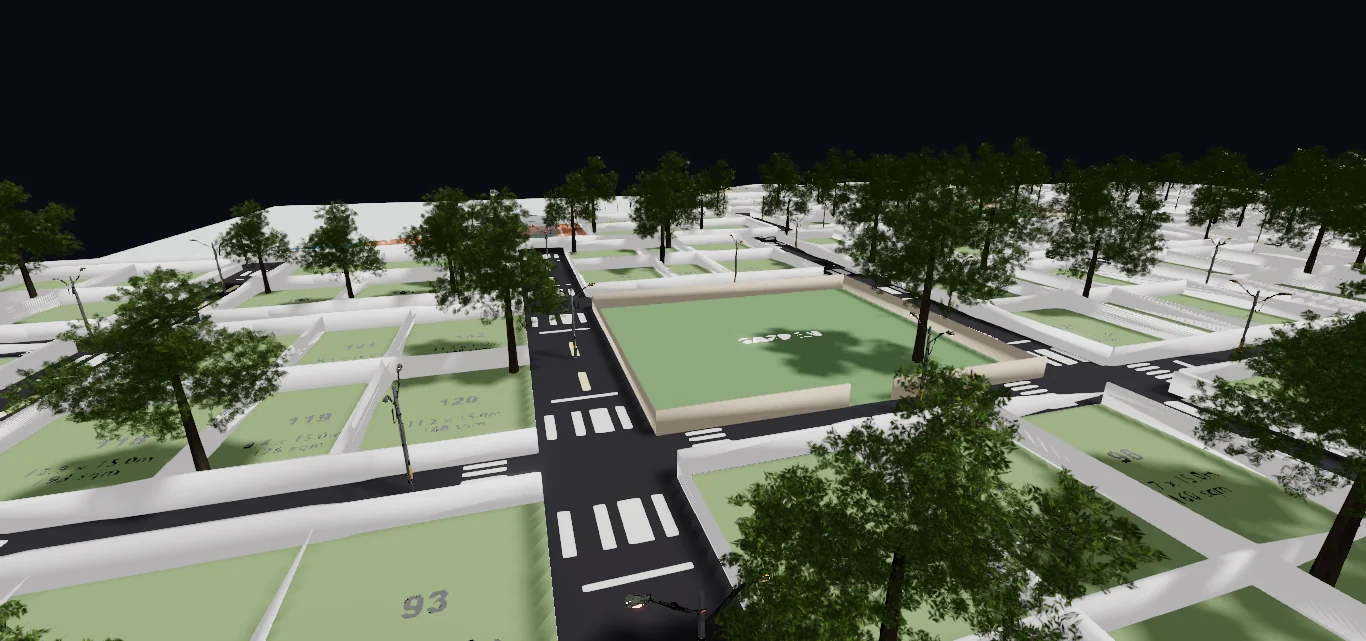
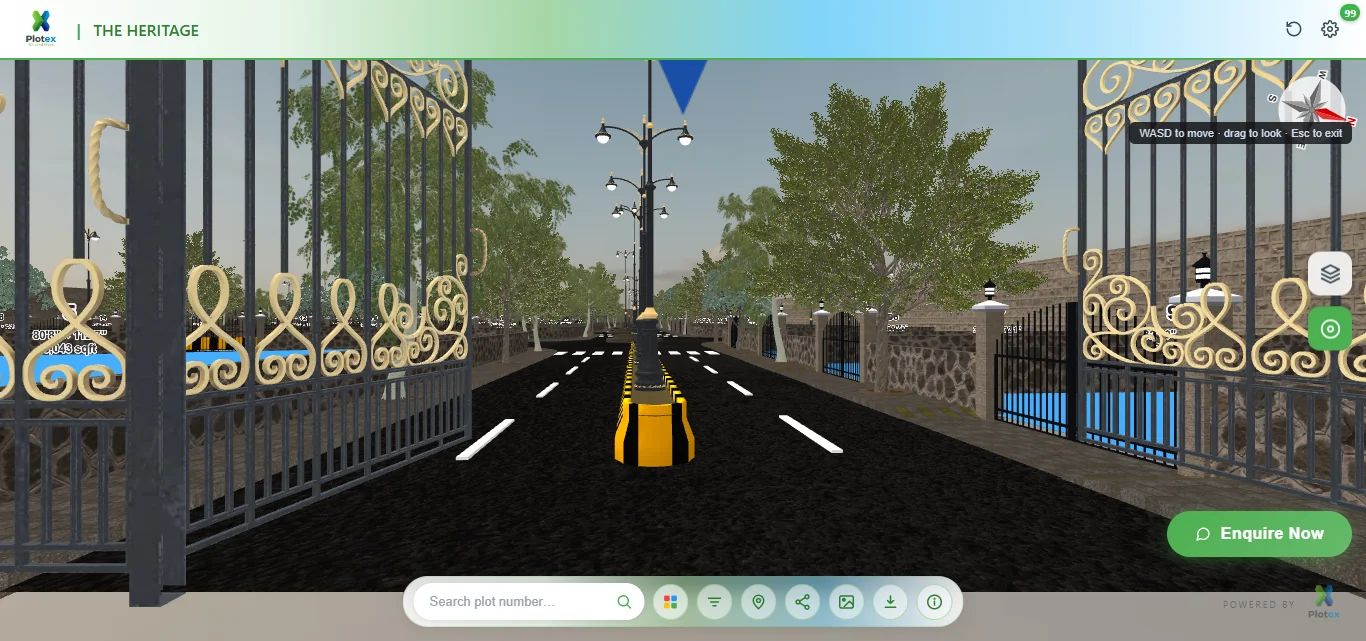
3D LAND MAPS
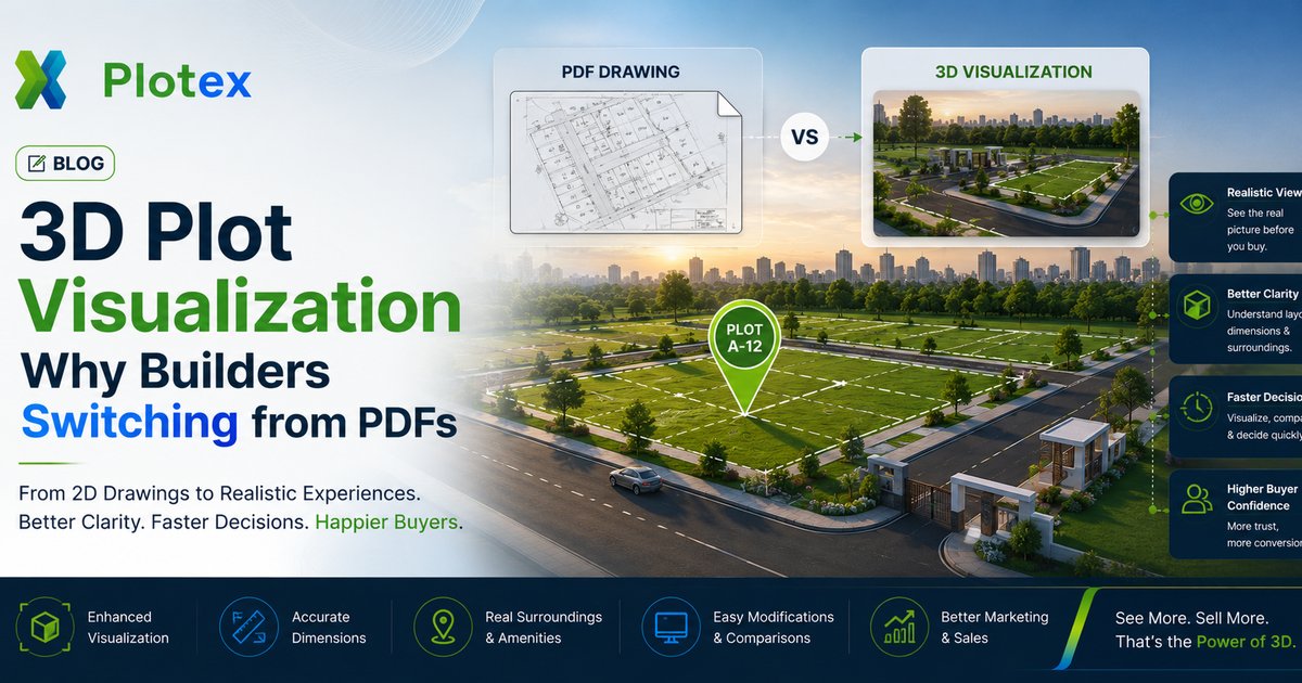
Transform traditional 2D paper maps into stunning interactive 3D visualizations. Navigate, explore, and understand your land investment with unprecedented clarity.


Upload your land plot PDF and we'll convert it into an interactive 3D visualization
Everything you need to visualize, analyze, and share land plot information
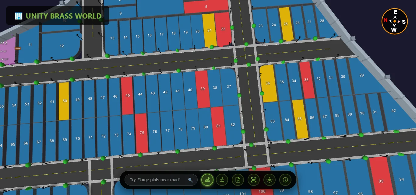
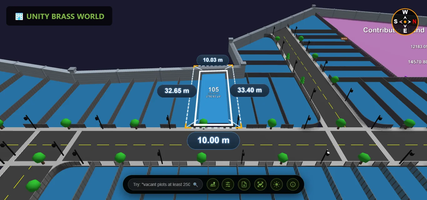
Interactive 3D environment with realistic roads, trees & boundaries
Manage leads, track user location, viewer analytics & inquiry data
Exact dimensions & area calculations with professional accuracy

Instant identification of available, sold & reserved plots
Filter by area, price, road proximity & booking status
Share via link, QR code or embedded viewer instantly
Share interactive 3D plots on any device — then capture, track, and manage every lead in one built-in CRM. No app, no spreadsheets, no missed buyers.
Every buyer who opens your 3D plot link is captured automatically — then tag, assign, and track follow-up status in one clean dashboard. No manual entry, no spreadsheets.
See exactly which plots get the most views and interest, so you know what's hot and which inventory to push.
Track each buyer's journey — which plots they viewed, how long they stayed, and what caught their interest.
Get an instant alert the moment a buyer shows interest in a plot — reach out while they're still hot.
Connect leads straight to WhatsApp and follow up where Indian buyers actually respond — right inside the flow.
Assign leads to brokers, track their performance, and manage your entire sales team from one place.
Share a link. That's it. Your clients view plots instantly with zero downloads or app store visits.
Chrome, Safari, Firefox, Edge — full 3D performance on every modern browser, desktop or mobile.
Once loaded, the 3D viewer works without internet. Perfect for on-site plot visits in low-signal areas.
Everything you need to know about Plotex
Plotex is a 3D plot visualization tool that displays land plots in an interactive 3D environment with a digital real-time experience. You can explore plot boundaries, check plot availability status, measure distances, and navigate the entire layout from any angle - all in stunning 3D.
Yes! Plotex is fully responsive and works seamlessly on desktops, tablets, and mobile phones. Access your 3D plot visualizations from anywhere, anytime, on any device with a web browser.
Plotex provides highly accurate measurements based on the scale of your original map. Our precision measurement tools allow you to calculate distances, areas, and boundaries with professional-grade accuracy suitable for real estate and land development purposes.
Plotex is ideal for real estate developers, land surveyors, property buyers, urban planners, architects, and anyone involved in land transactions. It helps visualize plots clearly, making it easier to explain layouts to clients and stakeholders.
Tips, guides, and news about 3D plot visualization
Explore our 3D plot viewer software, plot layout software, and how to sell plots online.

Top 10 Indian cities for plot investment ranked — Hyderabad, Bengaluru, Pune, Chennai, Jaipur and more.

The complete pre-purchase verification checklist for plot buyers — RERA, EC, 7/12, and 3D view tips.
Conversion data, NRI buyer trust, WhatsApp shareability — why builders are dropping PDFs.
Join hundreds of real estate developers who have modernized their plot viewing experience